N and I went on a road trip this past weekend, leaving from Denver on Friday morning and heading across Colorado and into Utah. After driving for many hours, we stopped at some slot canyons south of the town of Green River, Utah, and went for a short hike.
Apologies for low-quality pictures, I forgot my camera and had to use my mobile!
The landscape here looks tortured from the air, the product of many many years of water winding its way through the desert:
View Larger Map
| | |  |
| Looking towards the Henry Mountains from south of Green River, Utah |
That night we ate in a small bar in Green River and watched the Rangers finish off the Yankees in the ALCS. There was not a lot of Yankees support amongst the patrons or bartenders.
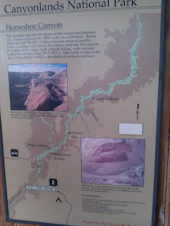
The next morning we went to another series of slot canyons for more hiking. This notice was posted at the trailhead:
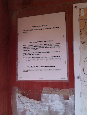 |
| Poor Grumpy. |
During this hike, we were near to the slot canyon where
Aron Ralston had his fateful adventure in 2003.
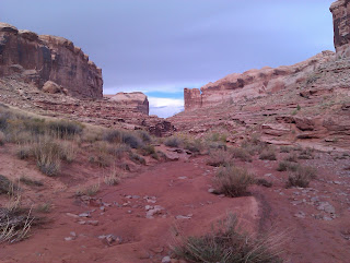
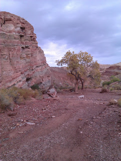 |
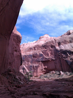
| The wide part of the wash, leading back towards a series of slot canyons. |
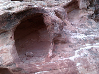
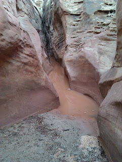
Slot canyons are narrow (sometimes very narrow!) canyons formed from water running through soft sandstone. The sandstone can be exceedingly beautiful, and is often shaped into fabulous curves and waves by centures of rushing water.
 |
| Colors on wet sandstone. |
Sandstone also changes dramatically when wet; we had the (good? bad?) fortune to be visiting during an exceedingly wet weekend, and the rain makes the sandstone look darker and redder. It also makes it more crumbly and sand-like to the touch.
 |
| Fun sandstone formations. |
Some of those slot canyons are very narrow and in a few instances we had to climb up over obstacles or inch our way along the sides ("stemming" as it is known).
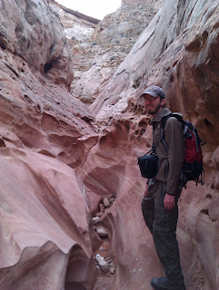 |
| N provides some scale to a slot canyon. If he was a bit skinnier, this picture would work better. |
Due to the rain I mentioned above, the slot canyons were wet and somewhat dangerous places to be. If a storm had come up when we were in them, we would have had to climb to safety because of the risk of flash flooding. Luckily that never happened but we did come upon a blocked passage full of icy water and had to turn around.
 |
| Water blocks our way! |
This did not prevent us from greatly enjoying our hike though!
 |
| Obligatory slot canyon portrait. |
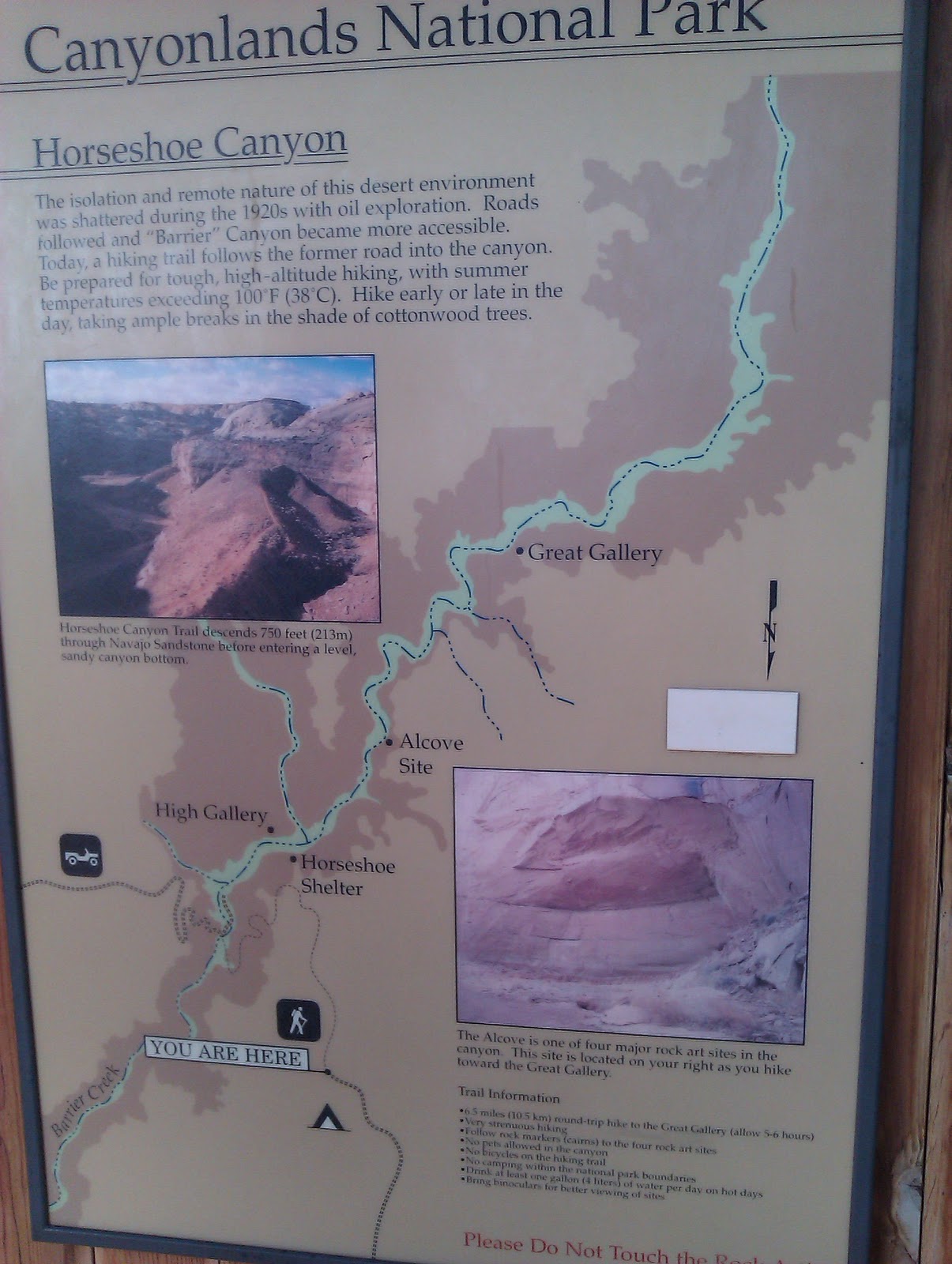
Our next stop was Horseshoe Canyon, which is part of Canyonlands National Park.
View Larger Map
Our hike here took us down into the canyon, about 750ft below the desert, following an old mining road. The valley itself had high sandstone walls and a small creek running through it, with cottonwoods lining the creek edges. There was clear evidence of recent flash flooding. The walls of the canyon have several panels of rock art along them, which you can read about
here.
 |
| One panel, high up on a sandstone wall. |
It seems likely that the rock art dates from 500 BC - AD 1, and the dating evidence rests on motifs in the designs and radiocarbon dating (as detailed in that pdf above).
 |
| The canyon was stunning. |
Walking through the canyon, it was easy to get a sense of the prehistoric landscape and the people who had come before.
 |
| N provides scale to an alcove. |
 |
| Rock art panel. |
 |
| "Great Gallery" of rock art. |
The rock art here is characterized by armless, anthropomorphic figures with dead looking eyes and smaller human and animal figures.
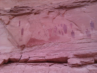 |
| Close up on one portion of "Great Gallery". |
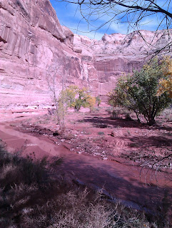 |
| The creek in the bottom of Horseshoe Canyon. |
 |
| Exit of the canyon, with the rocks rising like citadels. |
Just as we neared the end of the hike, having emerged out of the canyon and approaching the cars, we came upon the smallest rattlesnake I've ever seen. He was so small that he could barely rattle. He was sitting in the middle of the path and was positively terrified of us, trying to twitch his tail as fast as he could. We warned the people behind us and left the poor little guy alone.
 |
| A tiny cactus, found near to a tiny rattlesnake. |
|
|
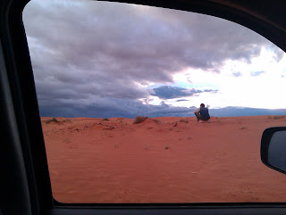
After our hike, we returned along the washboarded, muddy road back to the highway, chased by a massive lightning and rain storm. The skies were dramatic:
 |
| Storm approaching as we finished our hike. |
 |
| Map of our hike. |
The skies were really indescribable:
 |
| N takes a picture of the coming storm. |
That night we ate in tiny Hanksville, UT, which is a town with not a whole lot going on. I ordered a milkshake I'd been fantasizing about all day and it did not disappoint. Afterwards, we drove down a random desert road, trying to catch the Giants/Phillies game on a wavering and fading AM radio station from who knows where, and stopped the car in the dark to camp. Exhausted from our hikes and driving, we fell asleep almost instantly, dreaming of coyotes from space coming to howl at the nearly full moon as our desert lullaby
.
 |
| Morning light on the Henry Mountains. |
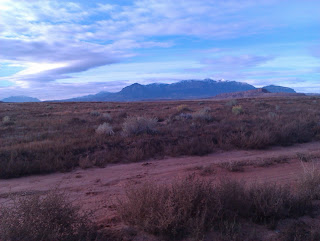
We woke up to a spectacular sunrise creeping up the distant Henry Mountains and sat in our sleeping bags watching it illuminate first the snowy tips of the peaks, and then the pine-clad slopes, and then slowly the red of the desert below.
After a very satisfying outdoors toothbrushing, we headed down the road towards Lake Powell. Along the way we saw a road leading off towards the Henry Mountains and decided that we couldn't pass it up, so we turned off.
View Larger Map
I'll finish up the trip in my next post, blogger has gotten unhappy with how many pictures I've put in here!


